Future Land Use Open House
- The proposed FLU map will be on display for public viewing and comment at the Picnic Shelter at the Pool Park on Wednesday, June 9 from 4 pm to 7 pm.
- Residents and landowners are invited to view and comment on the proposed FLU map during this time.
- Members of the Consultant Team from FIVE RULE will be available to explain the proposed FLU map and answer questions.
- A formal presentation of the proposed FLU Map will also be provided from 5:30-6:00 PM that evening.
WHAT IS THE FUTURE LAND USE MAP?
In June of 2020, the Cairo Village Board contracted with FIVE RULE Rural Planning to update the Village Comprehensive Plan (Plan). The Plan guides the Board’s land-use decisions over the next 10 years.
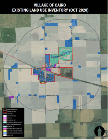
The map on the back of this flyer is the Village’s Existing Land Use (ELU) Map. The comprehensive plan process consists of the Board considering what attributes of the ELU that map should change and what should remain the same over the next 10 years. The Board makes these considerations with input from the Community and guidance from the Hall County Joint Planning Commission.
Those land use decisions are then represented on a second map, named the Future Land Use (FLU) Map. The FLU Map is the most important decision making page within the Comprehensive Plan. The Comprehensive Plan serves as baseline guidance for land use decisions while the Zoning Regulations are the local law regulating property development within the Village of Cairo and its one-mile zoning jurisdiction. The Zoning Map should reflect the Future Land Use Map. The FLU Map is not the same as the Zoning Map; however, it will guide the Board’s zoning decisions.